
The Complete Guide to Southern Thailand: Discover Nakhon Si Thammarat, Phatthalung and Songkhla
Explore Nakhon Si Thammarat, Phatthalung and Songkhla through ancient temples, wetlands, living culture and practical southern Thailand travel advice.
In this guideExplore the region
The Thailand That Isn't in the Guidebook
Begins about two hundred kilometres south of Surat Thani, where the road leaves the island ferries behind, and it runs down the eastern flank of the peninsula to the Malaysian border. Three provinces occupy it: Nakhon Si Thammarat, Phatthalung and Songkhla. Between them they hold the oldest continuously worshipped temple in the south, the largest natural lake in Thailand, a population of pink dolphins, a UNESCO-recognised dance form performed in village courtyards, and a culinary tradition that most Thais consider the fiercest and most sophisticated in the country.
Almost none of it appears in the guidebooks in any detail. The reason is not that these provinces are difficult or unrewarding. It is that Thai tourism developed westward, across the isthmus to the Andaman beaches, and southern travel infrastructure followed the money. Phuket had an international airport when Nakhon Si Thammarat had a landing strip. Sixty years later the imbalance has calcified into an assumption: that the south means islands.
This guide is written from the other side of that assumption. I grew up in a village in Nakhon Si Thammarat and I have spent the last three years building journeys through these three provinces for travellers who have already seen the islands and want something else. What follows is the orientation I wish someone had written before I started: what the region actually is, why it matters now more than at any point in living memory, and how to travel it in a way that is worth the effort of getting here.
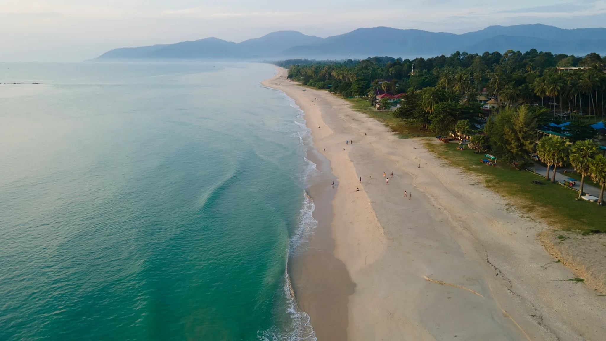
Where This Region Sits, and Why the Geography Matters
The Thai peninsula narrows here to a strip perhaps eighty kilometres across, with the Gulf of Thailand on one side and, beyond the mountains, the Andaman Sea on the other. That narrowness is the organising fact of the region. For two thousand years, goods and ideas moving between India and China had a choice: sail around the Malay peninsula, adding weeks, or land on one coast, cross the isthmus overland, and re-embark on the other. Many chose to cross. The crossing points became cities.
Nakhon Si Thammarat is the northernmost and the largest of the three provinces, and the oldest. It sits on a coastal sandbar with the Nakhon Si Thammarat range rising behind it, the peaks capped by Khao Luang at 1,835 metres, the highest mountain in southern Thailand. The mountains catch the monsoon and pour it down the eastern slope, which is why this is one of the wettest provinces in the country and why the fruit here is exceptional.
South of it, Phatthalung occupies the western shore of Songkhla Lake, a body of water so large that it functions as a small inland sea. The lake is not really a lake at all; it is a lagoon, connected to the Gulf at its southern end, which makes it fresh at the top, brackish in the middle and salt at the bottom. Three different ecosystems, one continuous body of water. This is why the wetlands at the northern end support wildlife found nowhere else in Thailand, and why the people who live around it have developed ways of fishing, farming and herding that the United Nations has formally recognised as globally significant.
Songkhla province wraps around the lake's eastern shore and southern mouth. Here the peninsula's other great current arrives: the maritime trade route between the South China Sea and the Indian Ocean, and with it Chinese merchants, Malay Muslim communities, Portuguese and Dutch traders, and the layered, argumentative, delicious culture of a port town. Songkhla Old Town is the physical record of that. Hat Yai, forty minutes inland, is its commercial descendant and the largest city in southern Thailand.
Understanding the geography makes the rest of the region legible. Mountains in the north-west, lagoon in the centre, sea on the east, border to the south. Everything the three provinces are — the Buddhism, the food, the dance, the fishing, the trade — grew out of that arrangement.
Why This Region Matters Right Now
For most of the last century, the cultural significance of these three provinces was understood locally and largely ignored internationally. That has changed with unusual speed over the past five years, and 2026 is the year it becomes visible.
The most significant development concerns Wat Phra Mahathat Woramahawihan in Nakhon Si Thammarat. In July 2026, at the 48th session of the World Heritage Committee in Busan, South Korea, the temple was inscribed on the UNESCO World Heritage List. It is Thailand's ninth World Heritage Site, its sixth cultural property, and — significantly for this region — the first World Heritage Site anywhere in southern Thailand. UNESCO recognised its outstanding universal value on the basis of more than fifteen centuries of continuous religious tradition, its role in spreading Buddhist art and architecture across maritime Southeast Asia, and its enduring character as a living place of worship rather than a monument.
It is not the only recognition. Nora, the acrobatic dance-drama of the southern provinces, was inscribed on UNESCO's Representative List of the Intangible Cultural Heritage of Humanity in 2021, the second Thai tradition to receive that status after Khon masked dance. In 2022 the Food and Agriculture Organization designated the Thale Noi wetland buffalo system in Phatthalung as Thailand's first Globally Important Agricultural Heritage System, recognising a way of herding water buffalo through seasonally flooded wetland that has shaped the landscape for centuries. And Songkhla, together with its ring of ancient lagoon settlements, was added to UNESCO's World Heritage Tentative List in 2024 — the formal first step towards nomination, on the grounds that no comparable lagoon settlement exists on the World Heritage List apart from Venice.
Four international designations in five years, in three provinces that most travel guides describe in a single paragraph.
What this means practically is that the region is at an inflection point. The recognition has arrived; the infrastructure and the visitor numbers have not yet followed. Travellers who come in the next two or three years will see these places substantially as they are, before the coaches arrive. That window is real and it is not permanent.
Nakhon Si Thammarat: The Ancient Capital
Nakhon Si Thammarat is the largest province in southern Thailand and, by a considerable margin, its oldest centre of power. Before there was a Thailand there was Tambralinga, a maritime state named in Pali sources as one of the prosperous port towns of the eastern world, ruled independently from the fifth century and for a period joined to the Srivijaya empire. The city that grew from it has been a Buddhist capital, a vassal, a provincial seat and a regional cultural engine, and it has never been fashionable. Thais call it Mueang Khon.
Wat Phra Mahathat Woramahawihan
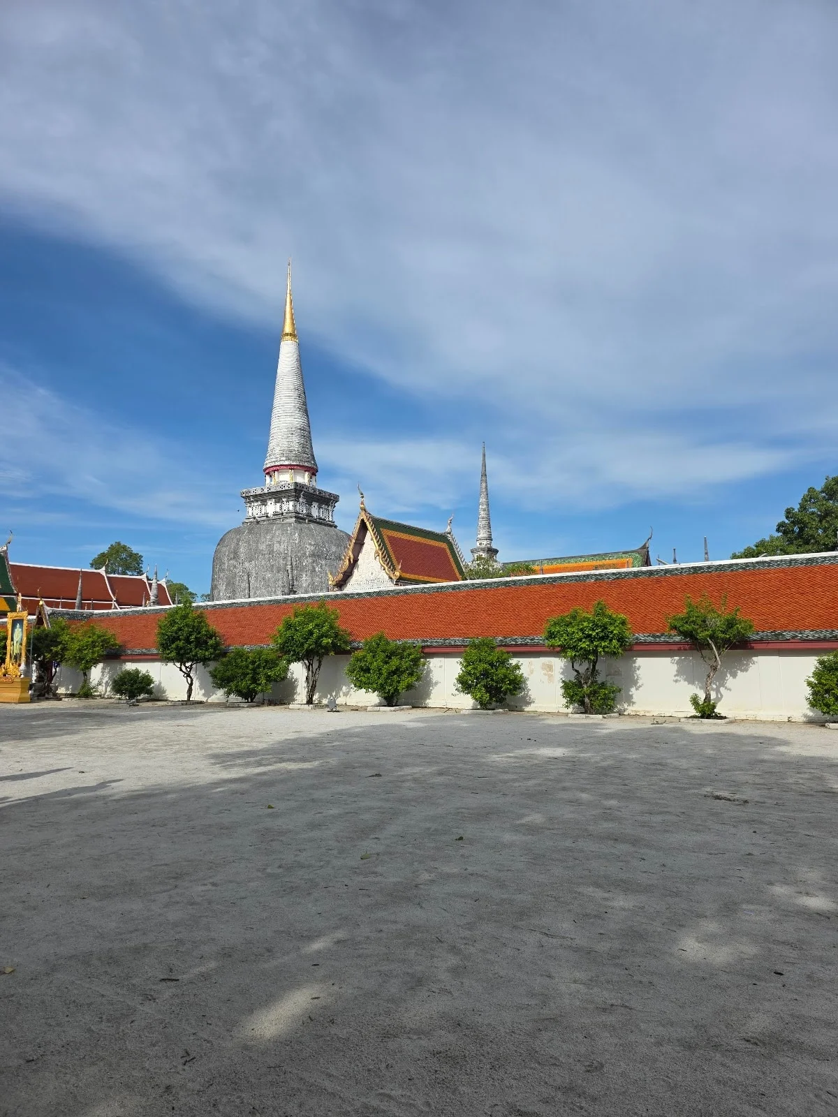
The temple is the reason most people come, and it deserves the trip on its own. At its centre stands the Phra Borommathat Chedi, a bell-shaped stupa roughly seventy-eight metres tall, crowned with a gold-clad spire that is visible from most of the city. It was built in the early thirteenth century to enshrine relics of the Buddha, and its form is Sri Lankan — evidence of the sea route that carried Theravada Buddhism from Lanka to the Thai peninsula and, from here, onward across the mainland. Temples across Thailand borrowed this silhouette. This is where the borrowing started.
What distinguishes it from Thailand's more famous temple complexes is that it is not a ruin and not a museum. It is a working first-class royal temple with a constant traffic of worshippers, and the atmosphere is entirely different from the archaeological parks at Sukhothai and Ayutthaya. Come at six in the morning and you will find the courtyard already busy: families circling the stupa, monks receiving alms, elderly women arranging marigolds and folded banknotes on the offering tables. The temple museum, built to house the accumulated donations of centuries, holds an extraordinary and haphazard collection of Buddha images, votive tablets and silverwork.
Once a year, at the full moon, the community carries an immensely long strip of painted cloth — the Phra Bot — through the streets and up around the base of the stupa, wrapping the monument in fabric in a ceremony called Hae Pha Khuen That. It is one of the great sights of Thai religious life and almost no foreign visitors see it.
The old city and the shadow puppet workshops
The city itself repays a slow day on foot. The National Museum is genuinely good — its Dvaravati and Srivijaya-period collection is the best context available for understanding what Tambralinga was, and it is rarely busy. Ban Tha Khun, a preserved wooden house near the temple, shows how a southern Thai family of means lived a century ago. The city pillar shrine, the municipal market and the surviving stretch of the old city wall can all be walked in an afternoon.
The essential stop, though, is a shadow puppet workshop. Nang talung, the southern Thai shadow theatre, is made from tooled and painted buffalo hide, cut into articulated figures fifteen to fifty centimetres tall and worked against a lit screen by a single puppeteer who voices every character, improvises the dialogue in southern dialect and delivers a running commentary on local politics. It is much closer to stand-up comedy than to solemn ritual. Several family workshops in the city still cut puppets by hand and will demonstrate the process; the studio founded by the late master Suchart Subsin is the best known and remains an active workshop rather than a display.
Kiriwong and the Khao Luang range
Twenty-three kilometres west of the city, at the foot of the mountains, the village of Kiriwong sits in a valley of fruit gardens with a cold clear river running through it. The village has been repeatedly named as having the cleanest air in Thailand, which is the kind of claim that invites scepticism until you arrive and breathe. Its economy is built on a traditional mixed orchard system the Thais call suan somrom — a layered planting of durian, mangosteen, langsat and petai grown under forest canopy rather than in cleared rows, which is both far more productive per hectare than it looks and effectively indistinguishable from jungle from above.
Kiriwong is the trailhead for Khao Luang. The full ascent is a three-day expedition with two nights camping, requires forest rangers, and is genuinely demanding; the climbing season runs from roughly January to June. Most visitors do not climb it. They walk a few hours into the fruit gardens, swim in the river, eat a lunch cooked in the village and come back down, which is a very good day.
The other side of the range holds Krung Ching, the finest waterfall in the province and one of the best in Thailand. Reaching the falls means a well-made forest trail of just under four kilometres each way through lowland rainforest of a quality now almost extinct in the south — which is why serious birders come here for hornbills, trogons and the Rufous-collared Kingfisher. Note that Krung Ching is on the far northern side of Khao Luang National Park, roughly a hundred kilometres from the park headquarters near Kiriwong, and the two cannot sensibly be combined in a single day.
The Khanom coast
In the far north of the province, facing Ko Samui across the gulf, Khanom is a district of long empty beaches, limestone headlands and a fishing town with one traffic light. Its distinction is biological. The waters off Laem Prathap and Khwaeng Phao bay hold a resident population of Indo-Pacific humpback dolphins — the pink dolphins — estimated at around fifty to sixty animals, which is a substantial share of the entire Gulf of Thailand population. They are grey at birth and lose pigmentation with age, and the pink comes from blood vessels close to the skin surface, a thermoregulatory adaptation rather than a colouring.
Sightings are most reliable from January to April in the early morning, when the dolphins follow the fishing boats. Operators run boats from the local piers. A word on ethics: the population is small and legally protected, and the difference between a well-run trip and a badly run one is entirely a matter of whether the boat approaches the animals or waits for them. Ask before you book. A proposal to formally protect the coast and islands as a national park has been advancing for years; at the time of writing it has not been declared.
Phatthalung: The Lagoon Province
Phatthalung is the smallest and least visited of the three, and for a certain kind of traveller it is the best. It has no beach resort, no international airport and no nightlife to speak of. What it has is water, mountains that erupt vertically out of rice fields, and one of the most extraordinary wetland landscapes in Southeast Asia.
Thale Noi before sunrise
Thale Noi — the name means "little sea" — is a shallow freshwater wetland at the northern end of the Songkhla Lake system, covering some 460 square kilometres as a designated non-hunting area. It has been protected since 1975. In 1998 the Kuan Ki Sian swamp forest within it became Thailand's first Ramsar site, the country's inaugural entry on the list of wetlands of international importance. Something close to two hundred bird species have been recorded here, with numbers swelling between October and March as migrants arrive from Siberia and China on their way south to Malaysia and Australia.
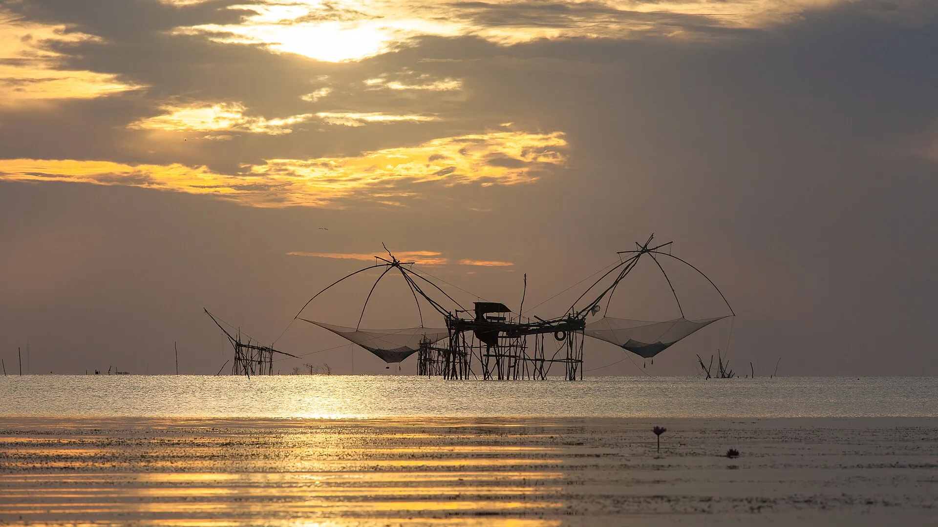
You go at dawn. This is not a preference, it is a rule. The long-tail boats leave in the dark from Ban Pak Pra or the Thale Noi pier, and the first light finds you out on open water among the yok yor — vast cantilevered dip nets on stilt platforms, silhouetted against a pink sky, worked by fishermen who have been out since three. Then the boat turns inland through channels barely wider than itself, into a world of flooded forest, floating vegetation, herons and painted storks and lesser whistling ducks lifting in sheets off the water. From roughly January through April the lake surface is carpeted with pink water lilies, which open at first light and close as the heat comes up. By nine o'clock it is over. The lilies have shut, the birds have dispersed and the light has gone flat.
The buffalo herders
The animals you will see standing chest-deep in the marsh are the reason Thale Noi carries an international designation that has nothing to do with birds. In 2022 the FAO named the Thale Noi wetland buffalo system as Thailand's first Globally Important Agricultural Heritage System. The herders here keep water buffalo on land that floods for nearly five months a year, moving them between seasonal pastures and, in high water, feeding them on floating platforms. The buffalo graze back the vegetation that would otherwise choke the wetland and reduce fire risk in the dry months; the wetland feeds the buffalo. The system is genuinely mutual, it is centuries old, and it is one of very few places on earth where you can watch pastoralism functioning as a conservation mechanism.
The villages around the lake also weave krajood, a wetland sedge, into mats and baskets, and it is worth buying directly from the weavers rather than from a shop.
Khao Ok Thalu and the town
Phatthalung town is small and pleasant and dominated by a single geological feature. Khao Ok Thalu — "the mountain with a pierced chest" — is a limestone massif rising about 250 metres directly behind the railway station, with a hole punched clean through near the summit. Local legend attributes it to a spear thrown in a fight between two mountains over a woman. It is on the provincial seal. A staircase of over a thousand steps goes up; the climb takes thirty to forty-five minutes and delivers a full circle of the province with Songkhla Lake glinting to the east. Do it at first light or not at all.
At the foot of the neighbouring crag sits Wat Khuha Sawan, the province's principal temple, built around a cave complex that has been a place of worship since roughly the eighth century. Baan Lam Pam, on the lake shore, was the provincial administrative centre before the twentieth century and is now a quiet village of lakeside seafood restaurants where Thais drive out for lunch.
Songkhla: Where Three Cultures Meet
Songkhla is the most cosmopolitan of the three provinces and the most misunderstood, largely because most visitors see only Hat Yai and conclude the province is a shopping city. Songkhla town itself, half an hour to the north-east on the coast, is a different proposition entirely: a working port with a preserved old quarter, a fine museum, two seas visible from one hill, and the best street food in the region.
The Old Town
Songkhla Old Town runs along three parallel streets — Nakhon Nok, Nakhon Nai and Nang Ngam — and can be walked end to end in an afternoon. The architecture is Sino-Portuguese shophouse, the same tradition that produced George Town in Penang and old Phuket, mixed with traditional Chinese timber buildings and, near the mosque, a Malay Muslim quarter where satay grills smoke on the pavement. Some buildings have been restored into cafés and small hotels; many have not, and the mixture of polished and peeling is precisely what makes the streets worth walking.
Hub Ho Hin, a huge red timber rice mill on Nakhon Nok Road, has been converted into a community heritage museum and is the best single building in the quarter. Nang Ngam Road — "beautiful woman road" — is the food street, with shophouse kitchens that have run the same recipes for three generations. A programme of murals commissioned from art students in 2016, inspired by Penang's street art, has grown into a hunt of a dozen-plus pieces across the old town. A weekend walking street runs along Chana Road on Friday and Saturday evenings.
This quarter, together with the ancient settlements ringing the lagoon at Sathing Phra, Phang Yang, Pha Kho and Si Yang and the fortified site of Singora at Khao Daeng, forms the property that Thailand placed on the UNESCO Tentative List in 2024 under the name "Songkhla and its Associated Lagoon Settlements". The nomination argues that the site represents a form of human settlement — a continuously inhabited lagoon culture shaped by maritime trade — that is unrepresented on the World Heritage List anywhere except Venice.
Samila, Tang Kuan and Ko Yo
Samila Beach on the town's eastern edge is a long crescent of sand with a bronze mermaid at one end that functions as Songkhla's civic emblem. Behind the town, Tang Kuan hill carries a small chedi and a funicular, and from the top you can see the Gulf on one side and the lagoon on the other — the reason the local park is called Suan Song Thale, the park of two seas.
Ko Yo, an island in the lagoon, is reached by road across the Tinsulanonda Bridge, the longest concrete bridge in Thailand. The island is known for hand-woven cotton in distinctive striped patterns, still made on treadle looms in village houses, and for the Institute for Southern Thai Studies — the Southern Thai Folklore Museum — which is the single best collection anywhere of the material culture of this region. If you have time for one museum in the three provinces, this is it. Its shadow puppet and Nora holdings alone justify the trip.
Hat Yai
Hat Yai is the commercial capital of the south, the transport hub, and for Malaysian and Singaporean visitors the destination in itself. It is a city for eating, shopping and dim sum breakfasts rather than for sightseeing, and it is the practical arrival point for the region because of its international airport.
In November 2025 Hat Yai experienced the worst flooding in its recorded history. On 21 November the city recorded 335 millimetres of rain in a single day, the heaviest in three centuries; the U-Taphao canal overtopped and much of the low-lying city went under. Recovery has been uneven. Hotels and transport returned to normal service through the first half of 2026, while smaller businesses have taken considerably longer, and the Tourism Authority of Thailand has run a sustained campaign to bring visitors back. Travel across all three provinces is operating normally. If you visit, spend money in small businesses; it matters here more than usual at present.
How to Travel the Three Provinces
Getting here
There are two airports. Nakhon Si Thammarat (NST) has multiple daily flights from Bangkok and puts you directly in the north of the region, about twenty minutes from the city centre. Hat Yai (HDY) is the international gateway, with connections from Kuala Lumpur and Singapore as well as Bangkok, and sits at the southern end. Flying into one and out of the other is the most efficient way to travel the region and avoids doubling back.
The overnight sleeper train from Bangkok is the alternative and, for travellers with a night to spare, the better experience. Services leave Bangkok in the early evening and reach Nakhon Si Thammarat in roughly twelve hours, continuing down the main southern line through Phatthalung to Hat Yai Junction. Second-class air-conditioned sleeper berths are comfortable and the line runs through the plantations and karst country of the upper south at dawn.
Getting around
A private vehicle with a driver is the practical solution and is not expensive by international standards. Distances between the three provincial capitals are modest — Nakhon Si Thammarat to Phatthalung is about two hours, Phatthalung to Songkhla about ninety minutes — but the places worth reaching are rarely in the towns, and public transport to trailheads, wetland piers and villages is limited or non-existent. Self-driving is straightforward on the main roads. Songthaew and local buses connect the towns cheaply if you are unhurried.
A seven-day route
Fly into Nakhon Si Thammarat. Spend the first two days in the city and at Wat Phra Mahathat, with a shadow puppet workshop and the National Museum, then move to Kiriwong for a day in the fruit gardens and the river. On day four, drive south to Phatthalung, arriving in time to arrange a dawn boat for the following morning on Thale Noi. Spend day five on the wetland and climbing Khao Ok Thalu. On day six, continue to Songkhla town for the old quarter, Ko Yo and the folklore museum. Fly out of Hat Yai on day seven. Ten days allows the addition of Khanom and the dolphin coast at the start, and Krung Ching waterfall, which needs a full day of its own.
When to Go
The eastern seaboard of southern Thailand runs on a different weather calendar from the Andaman coast, which is the single most common planning error travellers make. Phuket and Krabi are wettest between May and October. Here, on the gulf side, the heaviest rain arrives with the north-east monsoon from late October through December, and November is the wettest month of the year.
- January to April is the best window. Skies are clearest, the water lilies at Thale Noi are in bloom from roughly March, migratory birds are still present through March, and dolphin sightings off Khanom are at their most reliable. This is also the driest period for hiking in the Khao Luang range.
- May to September is hot, humid and subject to afternoon showers, but rarely washed out. Waterfalls run strongly, the fruit season peaks between June and August, and there are almost no other visitors.
- October to December is the north-east monsoon and should generally be avoided for a first visit. Rain can be prolonged and flooding is a genuine risk in low-lying areas, as November 2025 demonstrated.
Three festivals are worth planning around. Sart Duan Sip, in the tenth lunar month around September or October, is the great festival of Nakhon Si Thammarat: a ten-day observance in which families make offerings to ancestors released briefly from the underworld, culminating in processions and a fairground that takes over the city. Hae Pha Khuen That, the cloth-wrapping ceremony at Wat Phra Mahathat, is held at the full moon and is the region's most photogenic religious event. Chak Phra, in October, sees Buddha images pulled through the streets and along the waterways on decorated floats.
Travelling Here Well
These three provinces receive a small fraction of the foreign visitors that go to Phuket, Krabi or Chiang Mai. That is the attraction, and it is also a responsibility. The infrastructure that absorbs and normalises tourist behaviour elsewhere does not exist here. What you do is more visible and matters more.
A few things follow from that. Wat Phra Mahathat is a living place of worship, not a monument; dress covers shoulders and knees, and if a ceremony is under way, watch from the edge rather than the middle. Nora and nang talung are performed for communities, not for audiences, and the right way to see them is at a temple fair or a ritual you have been invited to, not staged in a hotel lobby. In the wetland villages, the boat drivers, weavers and buffalo herders are working, and asking before photographing is not an imposition. Where you can, buy from the person who made the thing.
And spend locally. In a region where tourism revenue is thin and unevenly distributed, the difference between money that stays in a village and money that leaves for a Bangkok head office is the difference between whether a young person in Kiriwong or Thale Noi can build a life at home. That principle is why South & Beyond Journey exists and why we structure our journeys the way we do. Where community is the destination, the economics have to follow.
Planning notes
Frequently asked questions
Is southern Thailand safe to visit?
Yes. Nakhon Si Thammarat, Phatthalung and Songkhla are safe for travellers, including solo women, and violent crime against visitors is rare. These provinces are not part of the deep south border region — Pattani, Yala and Narathiwat — for which some governments maintain travel advisories. Check your own government's current guidance before travelling. The practical risks here are road safety and seasonal flooding, not crime.
How many days do I need for Nakhon Si Thammarat, Phatthalung and Songkhla?
Seven days covers all three provinces at a reasonable pace, with two days in Nakhon Si Thammarat, two in Phatthalung and two in Songkhla, plus travel. Ten days allows you to add the Khanom coast and Krung Ching waterfall without rushing. Fewer than five days means choosing one or two provinces rather than all three.
What is the best time of year to visit?
January to April. This is the driest period on the gulf coast, coincides with the water lily bloom at Thale Noi and the most reliable dolphin sightings at Khanom, and offers the best conditions for hiking. Avoid late October through December, the north-east monsoon, when rainfall is heaviest and flooding is possible.
How do I get to Nakhon Si Thammarat from Bangkok?
By air in about ninety minutes, with several daily flights to Nakhon Si Thammarat Airport, roughly twenty minutes from the city. By overnight sleeper train in about twelve hours from Bangkok, arriving in the morning. By bus in around ten hours from Bangkok's Southern Bus Terminal.
Is Wat Phra Mahathat a UNESCO World Heritage Site?
Yes. Wat Phra Mahathat Woramahawihan was inscribed on the UNESCO World Heritage List in July 2026, at the 48th session of the World Heritage Committee in Busan. It is Thailand's ninth World Heritage Site, its sixth cultural property, and the first World Heritage Site in southern Thailand.
Can I see the pink dolphins at Khanom, and is it ethical?
Yes. A resident population of roughly fifty to sixty Indo-Pacific humpback dolphins lives off the Khanom coast, and boat trips run from local piers, with the best sightings between January and April in the early morning. It is ethical when the operator maintains distance and lets the dolphins approach rather than pursuing them. Ask operators directly about their approach policy before booking.
Do people speak English in these provinces?
Less than in Bangkok, Phuket or Chiang Mai. English is spoken at airports, larger hotels and some restaurants in Hat Yai and Songkhla town, but is limited in Phatthalung, in villages and among drivers and boat operators. A guide or a driver with English is a substantial practical advantage here in a way that it is not in the main tourist destinations.
What makes this region different from Phuket or Krabi?
These provinces are on the gulf side of the peninsula and have almost no international beach tourism. The draw is cultural and ecological rather than coastal: an ancient Buddhist capital, a UNESCO-recognised dance tradition, a globally designated wetland farming system, and southern Thailand's most respected regional cuisine. The weather calendar is also reversed, with the wet season falling in November rather than in the middle of the year.